Directions to 明孝陵 (玄武区) with public transportation
The following transit lines have routes that pass near 明孝陵
 Bus: 203路, 20路, 315路, 观光车5号线, 观光车6号线.
- Metro: 2号线, 4号线.
How to get to 明孝陵 by bus?
Click on the bus route to see step by step directions with maps, line arrival times and updated time schedules.
How to get to 明孝陵 by metro?
Click on the metro route to see step by step directions with maps, line arrival times and updated time schedules.
Bus stops near 明孝陵 in 玄武区
- 明孝陵, 6 min walk,
- 美龄宫, 8 min walk,
Metro stations near 明孝陵 in 玄武区
- 苜蓿园, 25 min walk,
- 岗子村, 52 min walk,
Bus lines to 明孝陵 in 玄武区
- 旅游专线2号线, 下马坊地铁站 - 明孝陵,
- 观光车3号线, 中山陵西 - 明孝陵,
- 观光车5号线, 灵谷寺景区 - 明孝陵,
- 观光车6号线, 明孝陵停车场,
- 旅游专线1号线, 明孝陵,
- 观光车1号线, 明孝陵停车场,
- 20路, 莫愁湖公园西门 - 明孝陵停车场,
- 203路, 迈皋桥广场 - 明孝陵停车场,
- 315路, 白马公园 - 五百户西,
What are the closest stations to 明孝陵?
The closest stations to 明孝陵 are:
- 明孝陵 is 385 meters away, 6 min walk.
- 美龄宫 is 478 meters away, 8 min walk.
- 苜蓿园 is 1895 meters away, 25 min walk.
- 岗子村 is 4079 meters away, 52 min walk.
Which bus lines stop near 明孝陵?
These bus lines stop near 明孝陵: 203路, 20路, 315路, 观光车5号线, 观光车6号线.
Which metro line stops near 明孝陵?
2号线 (经天路)
What’s the nearest metro station to 明孝陵 in 玄武区?
The nearest metro station to 明孝陵 in 玄武区 is 苜蓿园. It’s a 25 min walk away.
What’s the nearest bus station to 明孝陵 in 玄武区?
The nearest bus station to 明孝陵 in 玄武区 is 明孝陵. It’s a 6 min walk away.
What time is the first metro to 明孝陵 in 玄武区?
The 4号线 is the first metro that goes to 明孝陵 in 玄武区. It stops nearby at 6:13 AM.
What time is the last metro to 明孝陵 in 玄武区?
The 2号线 is the last metro that goes to 明孝陵 in 玄武区. It stops nearby at 11:35 PM.
What time is the first bus to 明孝陵 in 玄武区?
The 20路 is the first bus that goes to 明孝陵 in 玄武区. It stops nearby at 6:03 AM.
What time is the last bus to 明孝陵 in 玄武区?
The 20路 is the last bus that goes to 明孝陵 in 玄武区. It stops nearby at 9:26 PM.
See 明孝陵, 玄武区, on the map
Public Transit to 明孝陵 in 玄武区
Wondering how to get to 明孝陵 in 玄武区? Moovit helps you find the best way to get to 明孝陵 with step-by-step directions from the nearest public transit station.
Moovit provides free maps and live directions to help you navigate through your city. View schedules, routes, timetables, and find out how long does it take to get to 明孝陵 in real time.
Looking for the nearest stop or station to 明孝陵? Check out this list of stops closest to your destination: 明孝陵; 美龄宫; 苜蓿园; 岗子村.
Bus: 203路, 20路, 315路, 观光车5号线, 观光车6号线, 旅游专线2号线, 观光车3号线, 旅游专线1号线, 观光车1号线.Metro: 2号线, 4号线.
Want to see if there’s another route that gets you there at an earlier time? Moovit helps you find alternative routes or times. Get directions from and directions to 明孝陵 easily from the Moovit App or Website.
We make riding to 明孝陵 easy, which is why over 1.5 million users, including users in 玄武区, trust Moovit as the best app for public transit. You don’t need to download an individual bus app or train app, Moovit is your all-in-one transit app that helps you find the best bus time or train time available.
For information on prices of bus and metro, costs and ride fares to 明孝陵, please check the Moovit app.
Use the app to navigate to popular places including to the airport, hospital, stadium, grocery store, mall, coffee shop, school, college, and university.
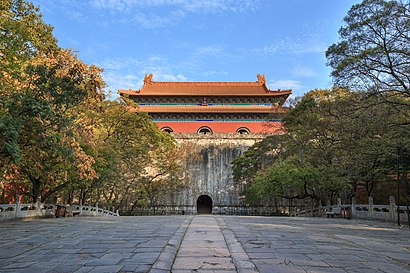
明孝陵 Address: Wengzhong Rd street in 玄武区
- Mingxiao Mausoleum (明孝陵),
- 南京中山植物园-标本馆,
- 森隆轩陶瓷艺术馆,
- 梅花山景区-北入口,
- 明孝陵梅花山,
- 明孝陵景区-旅游纪念品专卖,
- 李时珍塑像,
- 孝陵博物馆陈列室,
- 明孝陵大酒店,
- 观梅轩,
- 第一梅山,
- 山水含春,
- 明孝陵景区-售票处,
- 明孝陵(下客点),
- 植物分类系统园,
- 紫霞仙境-南门,
- 明孝陵(紫霞湖),
- 观光车6号线(明孝陵(紫霞湖)-中山陵停车场(紫岚里商业街)),
- 明孝陵(紫霞湖),
- 观光车3号线
Places Near 明孝陵 (玄武区)
- 江苏省人民医院,
- 南京儿童医院河西院区, 建邺区,
- 南京市第二医院, 鼓楼区,
- 玄武湖, 玄武区,
- 南京砂之船奥莱, 江宁区,
- 鼓楼医院江北分院, 浦口区,
- 德基广场, 玄武区,
- 南京明基医院, 建邺区,
- 南京市第一医院(河西院区), 建邺区,
- 三七八巷, 秦淮区,
- 金鹰超市(河西店), 建邺区,
- 南京夫子庙, 秦淮区,
- 南京航空航天大学(将军路校区), 江宁区,
- 中国人民解放军东部战区总医院, 玄武区,
- 中大医院-门诊部, 鼓楼区,
- 华东饭店-D楼, 鼓楼区,
- 南京博物院,
- 南京山姆会员商店, 雨花台区,
- 南京大屠杀遇难同胞纪念馆, 建邺区,
- 钟山宾馆, 玄武区
How to get to popular places in Nanjing with public transit
Get around 玄武区 by public transit!
Traveling around 玄武区 has never been so easy. See step by step directions as you travel to any attraction, street or major public transit station. View bus and train schedules, arrival times, service alerts and detailed routes on a map, so you know exactly how to get to anywhere in 玄武区.
When traveling to any destination around 玄武区 use Moovit's Live Directions with Get Off Notifications to know exactly where and how far to walk, how long to wait for your line, and how many stops are left. Moovit will alert you when it's time to get off — no need to constantly re-check whether yours is the next stop.
Wondering how to use public transit in 玄武区 or how to pay for public transit in 玄武区? Moovit public transit app can help you navigate your way with public transit easily, and at minimum cost. It includes public transit fees, ticket prices, and costs. Looking for a map of 玄武区 public transit lines? Moovit public transit app shows all public transit maps in 玄武区 with all Bus, Metro, Light Rail and Cable Car routes and stops on an interactive map.
Nanjing has 4 transit type(s), including: Bus, Metro, Light Rail and Cable Car, operated by several transit agencies, including 南京地铁, 南京有轨电车 and 南京公交